Identification of Critical source areas (CSA)
What
Areas of highest risk for contaminant transport and loss are areas such as gullies, swales or depressions, that are directly connected to waterways. These areas become temporary pathways for water after rainfall when soils are saturated or when the soil is water-logged. These areas become critical source areas depending on the land use, as they can contribute a disproportionately large amount of contaminants to the environment as runoff accumulates from adjacent flats and slopes, delivering it to surface waterways, such as rivers and lakes, artificial waterways and subsurface drains.
Consider your farm and manage critical source areas effectively:
If the critical source area is steep, extensive or eroded, manage the whole area.
If the critical source area is moderately steep or has a low gradient, manage the bottom half.
If the critical source area is wide and has a low gradient, manage the final part before overland flow can enter a waterway.
Why
Runoff from Critical Source Areas can carry sediment, microbes, and nutrients to waterways. Managing these areas well is a good way to reduce contaminant loss from your farm. Within each farm, small areas of land tend to be the source of disproportionately large amounts of pollution therefore confining mitigations to these areas can have much greater cost/benefit than targeting wider areas.
Critical source area management is all about planning and preparation to ensure these areas are protected at the time of highest risk.
Tips for good management:
Graze the areas lightly during the summer to ensure they have adequate grass thickness in winter (a sward of 10–15cm) and can capture overland flow from adjacent areas.
Do not cultivate the lowest parts.
Construct silt traps or ponds to capture sediment, nutrients, and bacteria.
Fence out stock and plant trees or allow natural native bush regeneration if an area is steep and eroded.
Strategically graze the area during intensive winter grazing, by starting at the top of slopes, back fencing, grazing towards the waterway / in the direction of water flow and leaving all critical source areas to last if in crop. If in grass, leave until growth resumes.
Keep plough lines back a minimum of three metres on flat ground, and more on steeper slopes when cultivating.
Adopt minimum tillage practices where possible and cultivate across slopes.
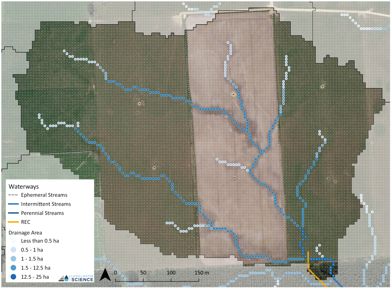
Example
Leaving the critical source area as a vegetated buffer aids in the reduction of contaminant export via physical filtering, the reduction of the velocity of runoff, and as a result, its capacity to transport contaminants. Buffer zones of 5, 10 and 30 m around the critical source area (ephemeral drainage network) are provided as an example of how high-resolution topographical mapping can be used to objectively identify these high-risk areas. Buffer widths can be further refined according to soil drainage properties and slope to allow a variable width buffer along the length of the critical transfer pathway.
By identifying and mapping areas these ephemeral drainage channels, critical source areas can effectively be identified. For example, the water trough would be better placed away from the critical source areas in the paddocks.